Our Communities
Town of Acton website: https://www.acton-ma.gov/
Acton is a suburban community located 25 miles northwest of Boston and situated in the southwest of the Greater Merrimack Valley region. Incorporated in 1735, the town has retained much of its rural New England character, as evidenced by the traditional town center, its green, the Arboretum, fine examples of historic architecture, and its stone walls and tree-lined country roads. A wide range of retail stores and services, a community theater, various types of commercial recreation and the Discovery Museum can all be found in Acton.
Acton is a business-friendly community, with a recent history of approving tax incentives for companies moving into the town. Corporations including Associated Environmental Systems, Insulet Corporation, and Haartz Corporation are headquartered in Acton and are working with the town and MassHire to create the Acton Area Manufacturing Collaborative to match job seekers with the training necessary to become valuable manufacturing employees.
 Town of Ayer website: http://www.ayer.ma.us/
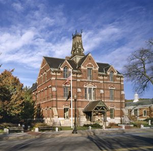
Ayer is a thriving town in the historic Nashoba Valley of Massachusetts. It is located 35 miles northwest of Boston, and within easy access of Interstate 495 and State Route 2. We are proud of our diversity, safe and beautiful neighborhoods, excellent schools, strong links to the railroad and Devens, quaint downtown, appreciation and protection of our natural resources, and our focus on the well-being of families and the community.
 Town of Bolton website: http://www.townofbolton.com
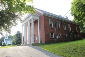
Bolton is a residential and agricultural community on the east slope of the Nashua River Valley on an historic east-west corridor. With many hills but few streams for power, it developed as an agricultural community. Rich forests and lime deposits also supported limestone quarries and kilns which once produced potash, lime, and brick products.
After the devastation of early Lancaster in the 1675-76 massacre, the land to the east of the river began to be settled by displaced settlers and new English immigrants who built prosperous farms for a population that increased slowly after King Philip’s wars. In 1681 the earliest birth was recorded in the Bolton Territory, and in 1738, the town was incorporated. By the 1800's, the economy added orchards and dairy farming. Much of its rural heritage is preserved in its current form as a residential suburb for nearby industrial communities and an exurb of Greater Boston.
Town of Boxborough website: https://www.boxborough-ma.gov/
Boxborough is a small, thriving community located at the crossroads of Interstate 495 and Route 111. Its excellent school system, high quality housing, convenient location, and scenic, historic and rural character make Boxborough an attractive community in which to live and work.
Town of Carlisle website: https://www.carlislema.gov/
The Town of Carlisle offers peaceful residential living located within a short ride of Boston. Once called “city of the woods” by Henry David Thoreau, Carlisle maintains a rich tradition in the preservation of open space and scenic ways. Nearly 20% of the town’s 15 square miles is dedicated conservation land. The town is the home to the only working cranberry bog in Middlesex County, as well as the beautiful Great Brook Farm State Park.
Carlisle residents enjoy the rural charm of a New England farming community with winding roads weaving past stone walls, fields farmed for generations, and unspoiled woods. The visual characteristics, combined with its geographical location and the commitment of its residents to providing a quality education for Carlisle children, make this community highly desirable.
 Town of Clinton website: http://www.clintonma.gov/
Originally Clinton began as the Mill District of Lancaster.
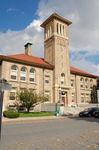
In 1828 the Bigelow brothers, Erastus and Horatio started an industrial revolution that left a lasting mark on the many aspects of Clinton. Erastus, a mechanical genius, invented the power loom for manufacturing coachlace, counterpane cloths and gingham plaids. With Horatio, a marketing entrepreneur, the brothers captured a firm hold on the textile industry.
By 1848 unprecedented growth in the population and industry enticed local leaders to separate from the mothertown. After two years of negotiations, the Town of Clinton was incorporated on March 14, 1850.
The Bigelow’s and the Town of Clinton’s success continued with the development of the carpet loom. Bigelow’s carpets were of superior quality and were found in finest establishments including; the White House, the Waldorf-Astoria, and the SS TITANIC.
Clinton’s industrial foothold began to slip during the Great Depression of the 1930’s. As with many New England mill towns, businesses closed or moved away. Fortunately, the numerous mill buildings were discovered again during the 1970’s and 1980’s by modern day entrepreneurs and many successful business now thrive where the Bigelow’s left off.
Town of Concord website: https://www.concordma.gov/
 Devens website: http://www.devenscommunity.com/
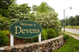
Set in Central Massachusetts, Devens is a 4,400-acre self-contained community that hosts world-class high-technology companies. Bordering the beautiful Nashua River, Devens has a carefully planned environment where businesses and residents alike can draw strength from each other and prosper.
After serving as the U.S. Army's New England Headquarters for 79 years, Fort Devens was closed in 1996. With the endorsement of the voters in the host towns of Ayer, Harvard, and Shirley, and the approval of the state, the property was conveyed to MassDevelopment, a quasi-public economic development and real estate agency tasked with stimulating economic investment across Massachusetts. MassDevelopment is redeveloping Devens by creating a sustainable and diverse residential and business community. With nearly 2,100 acres of open space and recreation lands, Devens offers unique opportunities for active and passive recreation to area residents. Stimulating economic activity and job creation are key goals. MassDevelopment currently provides municipal services, education, environmental protection, and the infrastructure improvements to convert the former military installation into a planned community. Devens has become a national model for military base reuse. Carefully planned progress continues along with a multitude of first-class amenities that make Devens a popular place to live, work, and play.
 Town of Dunstable website: https://www.dunstable-ma.gov/
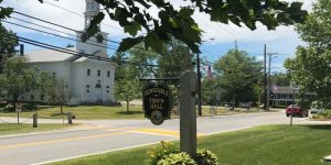
Dunstable is a rural community located just south of the Nashua, New Hampshire border which encompasses a little under 17 square miles. Besides Nashua, Dunstable is also bordered by Hollis, New Hampshire at its northwest edge, Pepperell to the west, Tyngsborough to the east and Groton to the south. The majority of the town is zoned single family and farming with an estimated population count of fewer than 3,300 people spread out amongst some 1000 +/- households.
 Town of Groton website: http://www.townofgroton.org/
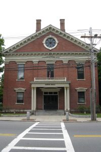
Groton, founded in 1655, has a population of 10,873 (2012 Town Census) and is located in the Nashoba Valley area in northwestern Middlesex County. The town is governed by Town Meeting. With an area of 32.54 square miles, Groton is the largest town in Middlesex County. There are 106 miles of plowed or maintained roads within the town. Town Hall is 320 feet above sea level and the highest elevation is at Chestnut Hills at 516 feet above sea level.
 Town of Harvard website: http://www.harvard.ma.us/
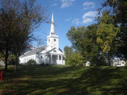
Harvard is a well preserved rural community with an interesting history extending back to 1732 when the town was incorporated. It has an open town meeting form of government and a five member Board of Selectmen. The population as of January 1, 2007 was 5,785 (includes 212 Devens residents). Situated in Worcester County, Harvard is 32 miles west of Boston, and 22 miles northeast of Worcester. The town is bordered by Ayer, Bolton, Boxboro, Lancaster, Littleton, Shirley, and Stow. Routes 2 and 495 run through the town, and the Nashua River forms its western boundary.
 Town of Lancaster website: http://www.ci.lancaster.ma.us/pages/index
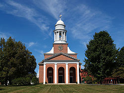
Lancaster was incorporated in 1653, making it the oldest town in Worcester County. Today, Lancaster retains a sense of history with old houses scattered throughout the community and a church designed by Charles Bulfinch on the Town Green. Home to Atlantic Union College, apple orchards, farms, historic sites, ponds, and parks, Lancaster is a wonderful place to live and work.
Lancaster is located in North Central Massachusetts on Routes 2 and I-190, and is close to Route 495. Large tracts of land are still available off of Route 2 as this area is just now beginning to be developed.
 Town of Littleton website: http://www.littletonma.org/
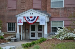
Littleton was first settled by white settlers in 1686 and was officially incorporated by act of the Massachusetts General Court on November 2, 1714. The town was also the location of the sixth Praying Indian village established by John Eliot called Nashoba Plantation, on the land between Lake Nagog and Fort Pond.
The first book published about Littleton, An Historical Sketch of the Town of Littleton, was written by Herbert J. Harwood and printed in 1890. It is available at the Reuben Hoar Library, the Historical Society, or on the Cornell University Library internet archive.
In his book, Herbert Joseph Harwood wrote: It is said that the name Littleton was given as a compliment to Hon. George Lyttleton, M.P., one of the commissioners of the treasury, and that in acknowledgment he sent from England a church-bell as a present to the town but on account of the error in spelling by substituting "i " for "y," the present was withheld by the person having it in charge, who gave the excuse that no such town as Lyttleton could be found, and sold the bell."
The minutemen and militia of Littleton marched and fought at Concord and the Battle Road on April 19, 1775. The militia company and the minutemen squads mustered at Liberty Square located on the southwest side of town on the Boxborough line (then part of Littleton). They marched from there through what is now Boxborough Depot and over Littleton Rd/Boxborough Rd to Newtown Road (Littleton), up over Fort Pond Hill (stopping briefly at the Choate Farm) and along Newtown Rd (Acton) to Acton Center. From there they marched the Isaac Davis Trail to Old North Bridge. Some writing suggests that the minutemen sped ahead to join the other minutemen at the bridge.
The town, according to local lore, did have a contingent of Loyalists who remained in town after the revolution and thwarted attempts to rename King Street as Main, Washington, or Adams Streets. This has been the source of ribbing from neighboring towns calling Littleton a Tory town.
 Town of Lunenburg website: http://www.lunenburgma.gov/
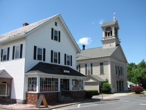
Lunenburg, incorporated in 1728, is governed by the open town meeting form of government. Occupying a land area of approximately 26.4 square miles, the Town is located in north central Massachusetts approximately 43 miles from Boston, it is bordered on the west by the Town of Ashby and the City of Fitchburg, on the south by the Town of Lancaster and the City of Leominster, on the east by the Town of Shirley, and on the north by the Town of Townsend.
Local legislative decisions are made by an open town meeting consisting of all registered voters in the Town. Subject to the legislative decisions made by town meeting, the affairs of the Town are generally administered by a board of five selectmen and a Town Manager. Local school affairs are administered by an elected school committee of seven persons while local taxes are assessed by a board of three assessors all appointed on an at-large basis for staggered three-year terms.
Town of Maynard website: https://www.townofmaynard-ma.gov/
 Town of Pepperell website: http://www.pepperell-mass.com/
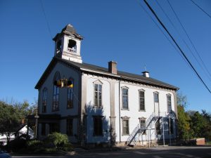
On the 12th day of April 1753, by act of the General Court, Groton West Parish, upon petition by its inhabitants, was made a district, and named Pepperell, in honor of Sir William Pepperell, the hero of the memorable capture of Louisbourg, in 1745. Reverend Mr. Emerson, who had been a chaplain in that expedition, probably suggested the name of his old commander as appropriate for the new district. Sir William acknowledged the compliment by the customary present of a bell, which, however, was never received by those for whom it was intended. Sir William always spelled his name with two "r"s, and for many years the name of the town was so spelled.
 Town of Shirley website: http://www.shirley-ma.gov/Pages/index
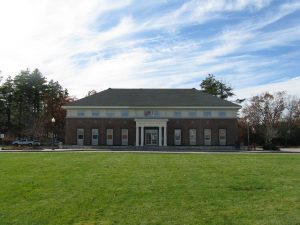
Located in Middlesex County about 50 miles north of Boston and only a town or two from the New Hampshire border, Shirley is governed by Open Town Meeting and a three-member Board of Selectmen. The town offers modern amenities and a slice of quiet, small town life, with rural ambience, a sense of civic pride and volunteer spirit among residents and well-preserved historic roots. The town has a full compliment of municipal services courtesy of the town’s police, fire and highway departments.
Shirley’s small but friendly business community has growth potential. A new regional school system shared with the neighboring Town of Ayer officially launched in 2011. Other perks include reasonably-priced homes, convenient commuter rail service via the train station in Shirley Village and highway access via Route 2A and nearby Route 2.
Settled in 1720 and incorporated in 1753, Shirley was named for a former governor. Some names in town are those of founding families and many handsome historic homes still stand, particularly in the picture-perfect Town Center, where the gracious white spire of Shirley’s Historic Meetinghouse rises high above the trees. The original section of the First Parish Meetinghouse was erected in 1773 and formerly housed religious congregations. More than a cherished landmark and charming timepiece today, the Historic Meetinghouse is lovingly preserved by a private group and hosts a variety of cultural and community events, some of which help pay for its maintenance.
 Town of Sterling website: https://www.sterling-ma.gov/
Sterling was once part of the territory of the Nashaway Indians, at one time the most numerous and powerful tribe in Massachusetts. Owing to an abundance of lakes and streams, the land that is now Sterling was home to native Americans as far back as 7000 BC.
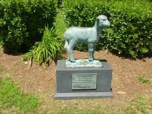
Sterling has had its share of prominent residents and their names can be found in the street names and places in the town and among present residents. Lt. Joel Pratt was an aide to George Washington during the Revolution. Pratt's Junction was named in his honor. In 1828, Silas Lamson invented the curved snath for the scythe which improved harvesting of hay and grains. Silas Stuart invented a machine to make sewing machine needles in 1860. In 1863, Ebenezer Butterick developed dress patterns. Mary Sawyer whose pet lamb was the inspiration for the poem, "Mary Had a Little Lamb" was born in Sterling in 1806. A statue commemorating the lamb stands on the Town Common.
Today the town retains much of its small town atmosphere, while its agricultural lands are giving way to residential and industrial development. For about 100 years, the population remained at 2,000. Since 1950, it has grown rapidly to over 8,000.
Town of Stow website: https://www.stow-ma.gov/
 Town of Townsend website: http://www.townsend.ma.us/
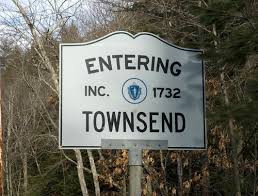
Townsend, Massachusetts was incorporated as a Town on June 29, 1732 and was named after Viscount Charles Townshend, a British cabinet minister. About 1780, residents and town clerks began to spell Townsend by omitting the "H" and giving it its present orthography.
The first mill of the town was built in 1733 in "Townsend Harbor." The pond at Townsend Harbor came into existence in 1734 when the dam was built for this mill. The Conant House, Grist Mill and Cooperage are places to visit now, in the Harbor. The Reed House belongs to the Historical Society and a "must" to visit.
A complete history of the town by Isthmar Sawtelle is in the public library and the office of the Town Clerk. Also, a book called Divinity and Dust, by Richard Smith, published in 1975 tells the story of Townsend's past. A record book of the Vital Records of Townsend was recently published in 1992, Vital Records from 1732 to 1850. Also, A Village Hooped in Steel, about the Fessenden family, written by Richard N. Smith, was printed in 1979 by Nashoba Publication.

 Town of Westford website: http://www.westfordma.gov/